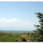
| Road from Konya to Beyþehir | |||||||||||
|
|||||||||||
|
|||||||||||
| Turkish Dictionary |
|---|
|
Turkish Chat |
|---|
| New in Forums |
|---|
|
Test Your Turkish Level
qdemir: Test your Turkish level ... ... C1) with free online tests — no ... |
|
Crossword Vocabulary Puzzles for Turkish L...
qdemir: You can view and solve several of the puzzles online at ... |
|
Giriyor vs Geliyor.
lrnlang: Thank you for the ... |
|
Local Ladies Ready to Play in Your City
nifrtity: my accout was stolen or what I ... write that |
|
Geçmekte vs. geçiyor?
Hoppi: ... and ... has almost the same meaning. They are both mean "i... |
|
Intermediate (B1) to upper-intermediate (B...
qdemir: View at ... |
| Random Pictures of Turkey |
|---|
| Most commented |
|---|